RTC continues efforts to expand transportation options, access to community resources during pandemic
Free transit passes for those returning to work and to vaccination appointments among new offerings
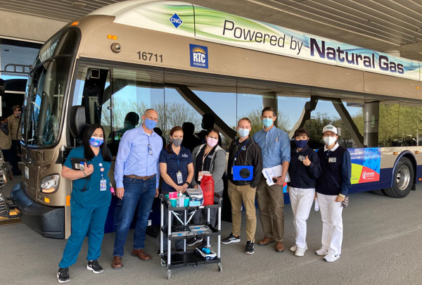 Over the course of the past year, the RTC of Southern Nevada has initiated new programs, collaborated with community partners, and adapted its operations to support the community. And as the region moves toward a full reopening, the agency is continuing its efforts to help in the transition back.
While COVID-19-related restrictions have loosened across the state in recent months and Clark County announced plans to remove social distancing and capacity limitations beginning on June 1, health officials are still urging anyone who is eligible to get vaccinated.
To do its part to help expand access to the COVID-19 vaccine, the RTC is providing free transit passes for vaccination appointments through the end of May. Both digital and paper passes are available.
Complementary paratransit rides to and from vaccination appointments are available to certified paratransit customers.
The RTC also publishes an interactive transit map with information on routes with stops at or near vaccination sites for those interested in taking fixed route transit. The interactive map is available at www.rtcsnv.com/vaccine-transportation-assistance.
As capacity restrictions are eased and businesses begin to welcome their employees back into the office, the RTC is also aiming to help the community return to work by offering two weeks of free transit rides to those re-entering the workforce.
Through its Try Transit program, two complimentary 7-day passes are available to Southern Nevadans returning to work. Proof of employment – such as an offer letter, return to work email from an employer, or copy of a work badge – must be uploaded upon sign-up to qualify.
“We recognize the impact the pandemic has had on our city, shuttering businesses and causing many to lose their jobs over the last year,” said M.J. Maynard, RTC chief executive officer. “As Southern Nevada prepares to fully re-open, we continue to pledge our commitment to the community by providing our workforce the opportunity to try transit for free.”
These recent offerings, which were largely made possible through federal stimulus funding, build on previous programs and initiatives the agency took part in over the past 14 months.
At the onset of the pandemic, RTC’s paratransit service partnered with Three Square Food Bank to make home grocery deliveries to homebound seniors. The agency also expanded its Silver STAR routes and included earlier start times to allow seniors the opportunity to take advantage of early-morning seniors-only hours offered by grocery stores.
And while the agency had to scale back its transit service in 2020 on account of lower ridership demand and declining revenue, the RTC is proposing to reinstate weekday schedules and add new service to the region.
Before making any service changes, the agency wants to hear from the community. To review the proposed changes and provide feedback, visit www.rtcsnv.com/servicechange2021. The public comment period is open through May 31.
For additional information on the proposed transit expansion, or any of the programs noted above, visit www.rtcnsv.com.
‘Access 2050’ Regional Transportation Plan adopted, 2021 priority projects underway
RTC transportation planning manager receives award for plan development, outreach
 Less than 5 months after Access 2050 – the region’s updated regional transportation plan (RTP) – was formally adopted, the region has already made progress toward the implementation of several priority projects.
Key projects identified in the plan that have been funded and are currently underway include:
- CC-215 Bicycle & Pedestrian Trail – Construction on a new bicycle and pedestrian trail along CC-215 in the northwest. The $6.8 million project will fill another gap in the CC-215 trail system.
- Boulder Highway transit – Design work for dedicated transit lanes and stations along a portion of Boulder Highway in Henderson.
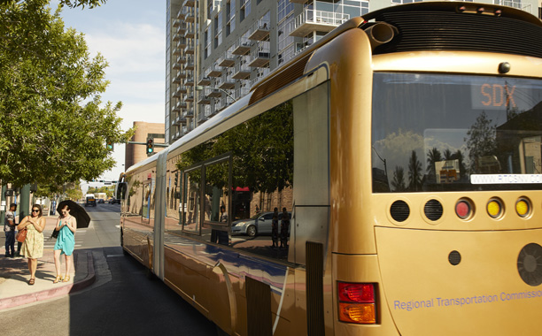
- Bus fleet replacement – Acquisition of new CNG buses by the RTC to replace some of its aging fixed-route fleet.
Access 2050 is the primary vehicle through which the RTC’s transportation planning process is implemented, serving as a blueprint for the region’s transportation investments – including roads, bikeways, sidewalks, transit, rail, and freight infrastructure – over the next 30 years.
More than 200 projects that aim to meet Southern Nevada’s short- and long-term transportation needs and help stimulate the region’s economic recovery were identified in the plan.
Andrew Kjellman, the project manager for the RTP update, was awarded Western Planner’s 2020 “Citizen Planner Award” for his efforts leading the project team through the challenges presented by the COVID-19 pandemic.
 Andrew Kjellman,
RTC transportation
planning manager
Under Kjellman’s direction, extra efforts were made to utilize technology and digital engagement to get input on the plan from the community. Efforts included a user-friendly website with a digital survey, a detailed video explaining the key components of the plan and significant projects, and heavy social media outreach.
More than 20,000 individuals were reached as a result of engagement efforts, resulting in thousands of social media comments, and nearly 500 survey responses. The community input was used to prioritize projects included in Access 2050, as well as craft a long-term transportation vision for the region, which was used to develop the plan’s overarching goals and strategies.
“COVID-19 created challenges across the country for community engagement and connection on all levels,” said David Swallow, RTC deputy CEO. “It is a testament to Andrew’s vision and dedication that we were able to engage on a new level with our community on a transportation plan that will impact the entire valley for decades to come.”
The RTP, which was adopted by the RTC’s board of commissioners in January, is federally required to be updated every four years.
For more information on Access 2050 and the transportation projects planned for Southern Nevada, visit rtcsnv.com/access2050.
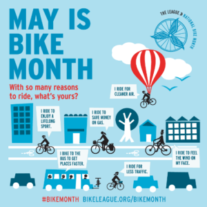
RTC celebrates National Bike Month, launches initiatives to make biking easier
First-of-its-kind app integration, discounted Bike Share passes among new offerings
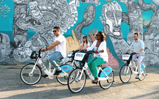 To celebrate National Bike Month, the RTC of Southern Nevada announced several new initiatives to get more Southern Nevadans moving on two wheels.
To help make planning for and taking multimodal trips easier, the RTC became the first agency in the country to fully integrate its bike share and public transit systems into a single app experience.
The new offering, available in the Transit app, enables users to plan a multimodal trip, purchase a transit pass, and unlock a bike through the RTC Bike Share system with just a few taps.
The agency also expanded its Bike Share pass options and is now offering reduced fares through a partnership with the Southern Nevada Health District.
Riders have the option of choosing between three tiers of Bike Share passes:
- DASHER (Daily pass, $5) – Offers unlimited 30-minute rides in a 24-hour period on a classic bike
- EXPLORER (Monthly pass, $15) – Offers unlimited 60-minute rides in a 30-day period on a classic bike
- DOWNTOWNER (Annual pass, $125) – Offers unlimited 60-minute rides in a 365-day period on a classic bike
EBT card holders are eligible to purchase the Explorer Monthly Pass for the discounted price of $5 or the Downtowner Annual Pass for the discounted price of $40.
 The RTC is also launching a free Bike Share loyalty program for its monthly and annual pass holders. Through the Bikecentives program, members earn bike accessories when making 50, 150, and 300 Bike Share rides in a calendar year.
This year’s prizes include a backpack, collapsible water bottle, and a portable speaker.
The Southern Nevada Strong Regional Plan prioritizes making biking easier and safer to increase transportation choice throughout the region.
To learn more about RTC’s cycling efforts and initiatives, go to rtcsnv.com/bikemonth.
National Bike Month, first celebrated in 1956, is held every May the U.S.
Interactive map identifies areas most vulnerable to extreme heat in region
 Source: National Weather Service, Las Vegas Office. Click to enlarge.
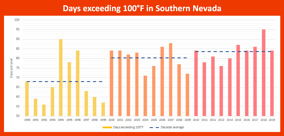
Summer and its triple-digit temperatures are just around the corner. And if it feels like summers are getting hotter and hotter each year, that’s because by many measures they have been.
Southern Nevada has been identified as one of the fastest warming regions in the U.S., with temperatures increasing more than 5 degrees Fahrenheit since 1970.
The number of 100-degree days per year in the region has also been on the rise over the past three decades, according to National Weather Service data.
With increasing temperatures come a host of negative impacts – from prolonged drought that contributes to strains on the region’s water supply to the stretching out of the allergy seasons.
But, most importantly, studies have found a clear link between rising temperatures and increasing heat-related deaths and hospitalizations.
Despite the history of adverse health impacts associated with extreme heat in our region, experts hold that many of these outcomes are preventable.
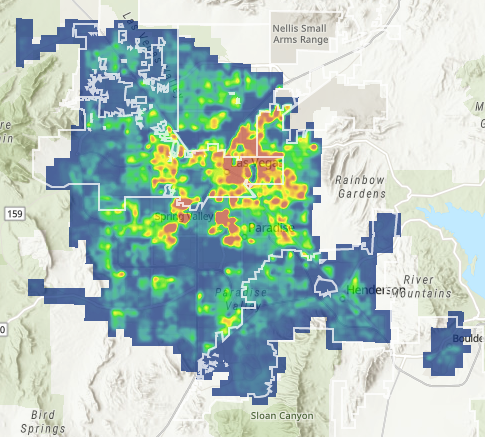
It was with this in mind that the planning staff within the RTC of Southern Nevada developed the Southern Nevada Extreme Heat Vulnerability Webmap. The interactive map allows users to identify areas in the region where the population is most vulnerable to extreme heat.
The new tool is a component of an extreme heat vulnerability study being completed by the Metropolitan Planning Organization (MPO) within the RTC.
Click to view the Southern Nevada
Extreme Heat Vulnerability Webmap
To identify areas in Southern Nevada where populations are most vulnerable to extreme heat, extensive data and spatial analysis was completed.
The analysis was built around the three dimensions of extreme heat vulnerability:
- Exposure – Levels of exposure to extreme heat can be impacted by both the natural and built environment
- Sensitivity – Health and physiological factors can predispose people to greater risk
- Adaptive capacity – The ability to prepare for or cope with extreme heat through economic, political or social means
The map was developed by analyzing demographic, health, and environmental data, and input from local subject matter experts and stakeholders.
The study, which is expected to wrap up this summer, will include a report of findings, as well as an overview of interventions and mitigation strategies other regions have implemented that could be considered in Southern Nevada.
There were nearly 600 heat-related deaths in Southern Nevada over the 10-year period from 2009-2018, according to Southern Nevada Health District (SNHD) data, with numbers spiking in the most recent years. And during the three years between 2016 and 2018, there were 619 heat-related emergency room visits in the region.
While these numbers are alarming, heat-related health outcomes are almost certainly undercounted, according to both public health and medical experts, due to the way this data is captured in hospitals.
For additional information on the extreme heat vulnerability study and project updates, visit the project webpage.
NDOT’s ‘Downtown Access Project’ studying possible I-515 expansion, safety enhancements
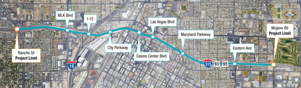 Project map shows location of project improvements, future on/off ramps, and HOV interchanges. (Image courtesy of NDOT)
The Nevada Department of Transportation (NDOT), in cooperation with the Federal Highway Administration, recently launched the National Environmental Policy Act (NEPA) process for the Downtown Access Project, which aims to make improvements to the I-515 viaduct between Rancho Drive and Mojave Road.
The project will provide many new safety and mobility benefits for the region, according to NDOT, including adding capacity to the highway, improving motorist and freight movement throughout the region, and maintaining pedestrian and bicyclist access to downtown.
NDOT’s Goals for the Downtown Access Project include:
- Replacing the aging 1.6-mile viaduct on this portion of the highway with new infrastructure
- Improving access into and out of Downtown Las Vegas
- Improving safety and operations of the roadway
- Extending the region’s High Occupancy Vehicle (HOV) network along the I-515 and into downtown
The NEPA process is required whenever a federal agency develops a proposal to take major federal action that could have environmental effects.
THE SCENARIOS
Four design alternatives are currently being evaluated as part of the federally required environmental study:
- No-build scenario where the existing infrastructure is maintained as is
- Recessed scenario where the highway sits below ground level (Desert Inn Rd. between Paradise Rd. and Valley View Blvd is an example of this type of construction)
- Southern alignment scenario where the highway remains above ground at a similar height to what exists now, with large sections on earthen fill material instead of a continuous bridge, slightly south of the current alignment through the core of downtown Las Vegas
- Northern alignment scenario, which is very similar to the southern alignment, but the highway is slightly north of the current alignment through the core of downtown
Renderings and videos for residents to visualize and experience each option are provided on the Downtown Access Project webpage.
POTENTIAL IMPACTS
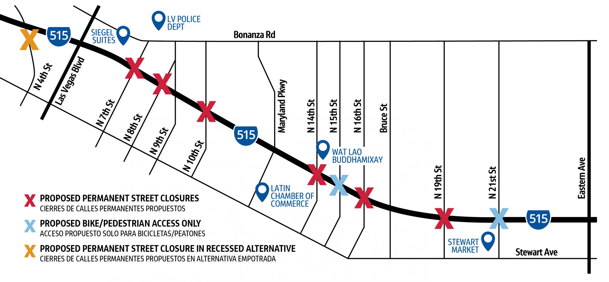
Click to enlarge. Map shows locations of potential permanent street
closures once the final design for the Downtown Access Project is selected,
which is expected to occur by the end of 2022. (Image courtesy of NDOT)
These options are not without potential impacts to the region and the East Las Vegas community.
With the I-515 viaduct reaching the end of its service life, the no-build scenario prolongs putting a solution in place. Infrastructure safety for the viaduct has been a concern for many years, and as the bridge continues to age, costly maintenance repairs will be needed.
A $34 million interim repair project to the viaduct is expected to start in June to extend the bridge’s life, but won’t negate the need for the eventual replacement of the viaduct.
The three build alternatives each propose permanent street closures, reducing connectivity to the areas north and south of the bridge. The recessed alternative includes the proposed closure of 4th Street at I-515, in addition to the other street closures.
Each build alternative also proposes widening the freeway to increase its capacity, which could result in the displacement of housing units, much of which is naturally-occurring affordable housing, and businesses. NDOT has met with local stakeholders, including the Southern Nevada Regional Housing Authority, to discuss these potential impacts.
Among the concerns of the East Las Vegas community is air quality. Therefore, a quantitative analysis of carbon monoxide and Mobile Source Air Toxics will be part of the project’s environmental study.
In the recessed and northern alignment scenarios, there will also be disruptions to the availability of public and private facilities and services in the area. At a minimum, the city will need to replace a fire station, a community center and pool, and other infrastructure in the area.
The southern alternative is proposed to not disrupt these public facilities.
ENGAGING THE PUBLIC

Click to enlarge
NDOT has completed two rounds of public outreach efforts with the community, in addition to meeting with many local stakeholders and businesses.
In fall of 2020, NDOT held virtual public meetings from August 24 to September 22 where the public could learn about the project and provide public comment.
NDOT just completed another public outreach effort where they temporarily closed streets that are proposed to be permanently closed when the project is built. The temporary closures were intended to help residents understand the impacts these closures may have on their lives in order to provide feedback to NDOT.
It is NDOT’s goal to keep the public and community engaged throughout the project so it can fully understand how the project may affect residents and businesses in the area and afford the opportunity to provide input on the project design and ways to avoid or minimize project impacts.
Feedback can be provided by phone at (702) 938-5440 or via email at [email protected].
Future meetings to learn about the project and provide feedback will also be available. Interested parties can receive project updates and meeting notifications to stay connected throughout the duration of the project. All communications are available in English and Spanish.
ADDITIONAL INVESTMENT IN EAST LAS VEGAS
The Downtown Access Project does stand to open up new opportunities for the East Las Vegas community, and through the Statewide Transportation Improvement Program (STIP), the city has programmed significant investments for local roadway improvements.
Much like what was done in the Las Vegas Medical District during Project Neon, the city will seek to improve street connectivity and increase transportation choices through complete streets improvements that are adjacent to the project site throughout downtown and East Las Vegas.
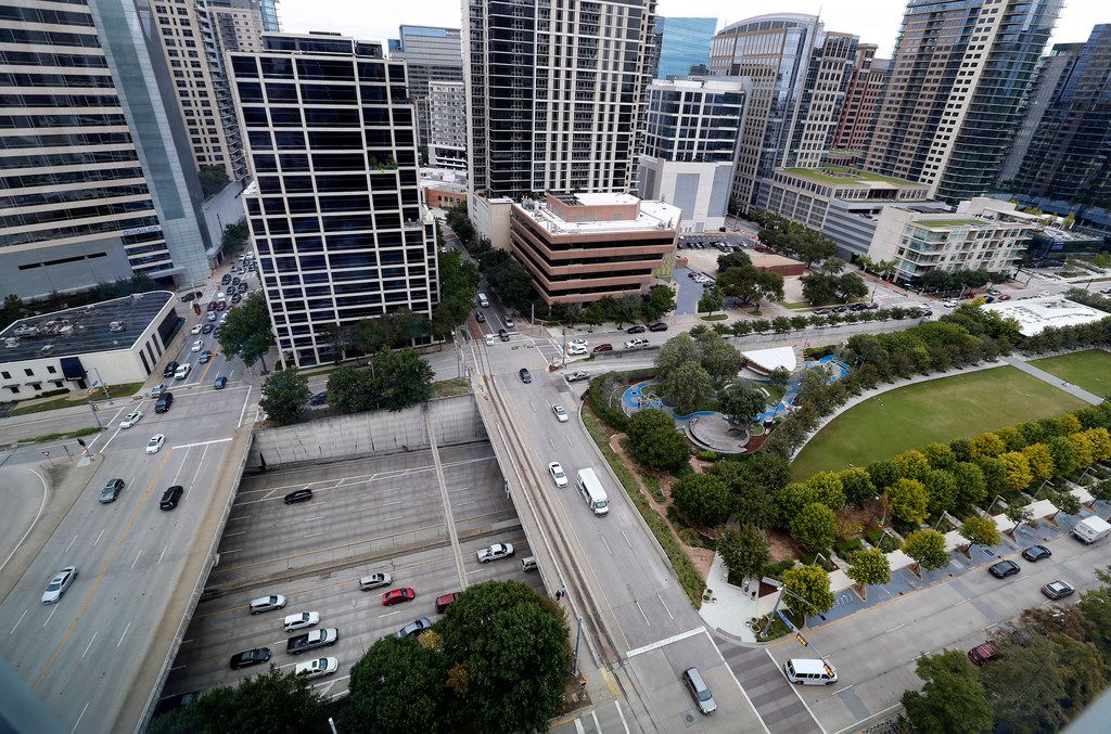 Klyde Warren Park is a 5.2-acre public park built over
the Woodall Rodgers Freeway in downtown Dallas.
(Photo by Tom Fox/Dallas Morning News)
Future improvements may include retrofitting Bonanza Road into a “Grand Paseo,” a concept that was introduced in the city’s 2050 Master Plan to incorporate wider sidewalks, bike lanes or cycle tracks, and other pedestrian and cyclist safety improvements.
In fact, the East Bonanza Safety Corridor project is currently underway, which will analyze data and stakeholder input and result in an infrastructure improvement plan that allows all modes of transportation to safely share the road.
The city is also looking at the possibility of a “cover park,” similar to the Klyde Warren Park in Dallas, a project focused on reclaiming and repurposing space above and around a recessed highway.
Capital projects will be solidified once the completed NEPA process has selected a design for the freeway improvements.


